|
12 October 2016
Signs of the Times - Bedford Road Oct 2016


20 September 2016
Animated Gifs
    "Mum! Mum! I'm drowning. I can't hold on for much longer! Help! help! I'm drowning. "              g ww  |


 |  |  |
 |  |  |
 |  |  |
11 September 2016
Flying Ants Photographed at Houghton Rocks 2016
Houghton Rocks, 2016. A miserable rainy day, but cheered up by a cheery set from the Flying Ants.
"The Flying Ants (Beatles Tribute Band, 4 piece) are at The Old Sugar Loaf, Dunstable, Friday 25th Nov 2016.
Flying Ants infest the oldest venue in town. In fact, if you add up the ages of the Flying Ants, it equals the year the Old Sugar Loaf was built - or not. Use your loaf, come and join us . . . 9.30pm - 1am"
     |
28 May 2016

27 March 2016
Houghton Regis Viewed From the North
The images opened in new window to their maximum are only 50% of the original sizes.
 1. Tithe Farm, Houghton Regis. Left to right: Background L&D Hospital, in front of that some homes in Pastures Way, Luton. Moving right, Thorn Hill Close, Thorn Hill School, Grove Road. Open in new window
 2. Tithe Farm, Houghton Regis. Left to right: Grove Road, Tithe Farm Road. Open in new window
 3. Tithe farm Road, Houghton Regis, Recreation Ground, Leaf Road. Open in new window
 4. Leaf Road, Houghton Regis, Tithe Farm County Primary Junior and Infants School, All Saints Parish Church, Churchfield Road. Open in new window
 5. Bidwell Hill, Plaiters Way, Roslyn Way, Taylor-Wimpey "Regency Place" construction site, Bedford Road, Bidwell. Background: All Saints Academy, Houghton Regis Chalk Pit. Open in new window
 The images were taken from Theed Way. "A road known as the Thiodweg or Theed Way was first recorded in the Chalgrave Charter of 926 [HER 10843] but may have had a prehistoric genesis. It ran roughly east-west across south Bedfordshire for twelve miles, through the parishes of Leighton Buzzard (where it crossed the River Ousel at Yttingaford, or Tiddenfoot, site of a peace treaty between King Edward the Elder (899-924) and the Danes in 906), Billington, Stanbridge, Eggington, Tilsworth, Chalgrave, Houghton Regis, Toddington, Sundon and Luton where it met up with Icknield Way. The road was used to carry salt from the fens of East Anglia westward." source: http://goo.gl/5ali3P"

 1. Tithe Farm, Houghton Regis. Left to right: Background L&D Hospital, in front of that some homes in Pastures Way, Luton. Moving right, Thorn Hill Close, Thorn Hill School, Grove Road. Open in new window
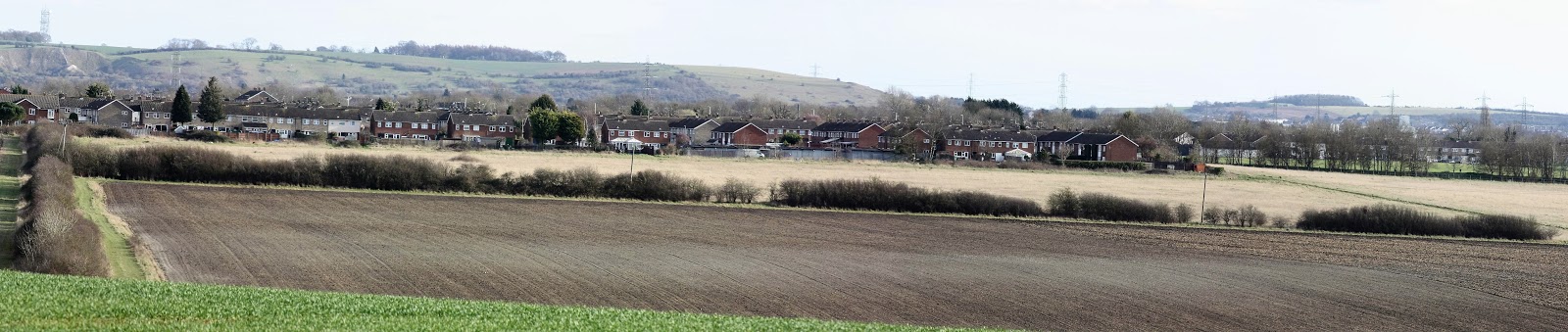 2. Tithe Farm, Houghton Regis. Left to right: Grove Road, Tithe Farm Road. Open in new window
 3. Tithe farm Road, Houghton Regis, Recreation Ground, Leaf Road. Open in new window
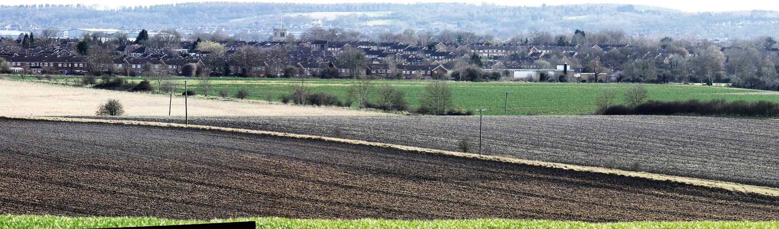 4. Leaf Road, Houghton Regis, Tithe Farm County Primary Junior and Infants School, All Saints Parish Church, Churchfield Road. Open in new window


Subscribe to:
Posts (Atom)